USGS - science for a changing world

USGS Coastal and Marine Geology Program

Historical Shoreline Changes at Rincón, Puerto Rico, 1936-2006


Title Page Introduction Methods Historic Shoreline
 Changes
Regional Bathymetry Discussion Future Outlook Conclusion Data Catalog Acknowledgments References

Figure 1. Map of the study area in Rincón, Puerto Rico. Image is a 2004 orthophotograph.

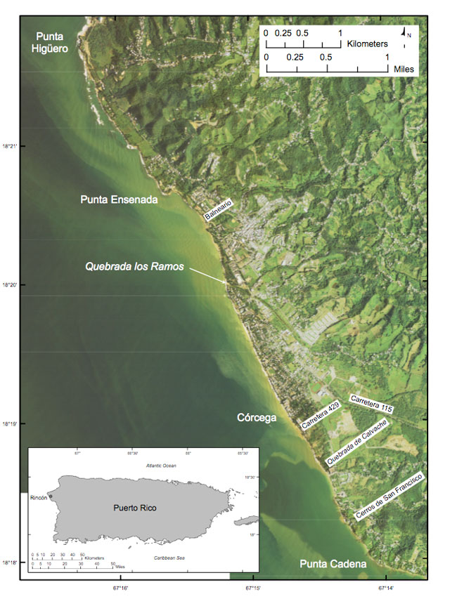
Figure 1. Map showing location of the study area in Rincón, Puerto Rico. (Image is a 2004 orthophoto.)

Skip Navigation

Accessibility FOIA Privacy Policies and Notices

U.S. Department of the Interior | U.S. Geological Survey | Coastal and Marine Geology

URL: cmgds.marine.usgs.gov/publications/of2007-1017/htmldocs/fig1.html
Page Contact Information: CMGDS Team
Page Last Modified: Wednesday, 06-Dec-2017 13:09:12 EST