USGS - science for a changing world

USGS Coastal and Marine Geology Program


Potential for Shoreline Changes Due to Sea-Level Rise Along the U.S. Mid-Atlantic Region

Back

Figure 3.  Map showing the potential sea-level rise responses for each coastal compartment.

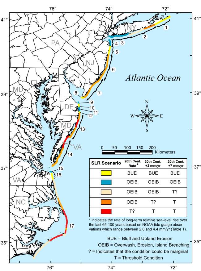
Figure 3. Map showing the potential sea-level rise responses for each coastal compartment. Colored portions of the coastline indicates the potential response for a given sea-level rise scenario according to the inset table. Numbers indicate the coastal compartments shown in Figure 1.

Skip Navigation

Accessibility FOIA Privacy Policies and Notices

U.S. Department of the Interior | U.S. Geological Survey | Coastal and Marine Geology

URL: cmgds.marine.usgs.gov/publications/of2007-1278/html/fig3.html
Page Contact Information: CMGDS Team
Page Last Modified: Wednesday, 06-Dec-2017 13:17:10 EST