USGS Coastal and Marine Geology Program
![]() Title | Geologic Setting | Introduction
| Methods | Bathymetric Overview |
Interpretation | Data Catalog
| Acknowledgments | References
| Figures
| Contacts
Title | Geologic Setting | Introduction
| Methods | Bathymetric Overview |
Interpretation | Data Catalog
| Acknowledgments | References
| Figures
| Contacts
 |
||
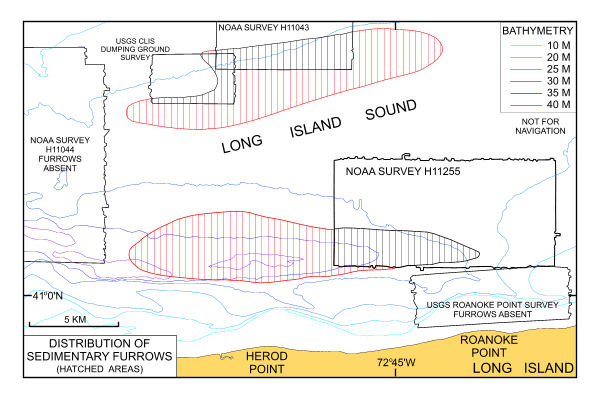
Figure 17. Map showing the distribution of sedimentary furrows in east-central Long Island Sound. Areas where sedimentary furrows have been observed are shown in black hatching; areas where the furrows are interpreted to occur are shown in red hatching. | ||
