USGS Coastal and Marine Geology Program
Historical Shoreline Changes at Rincón, Puerto Rico, 1936-2006
| Title Page | Introduction | Methods | Historic Shoreline Changes |
Regional Bathymetry | Discussion | Future Outlook | Conclusion | Data Catalog | Acknowledgments | References |
 |
||
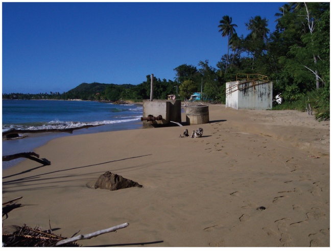
Figure 18. Photograph taken on 05 December 2005 showing infrastructure that is now on the beach and in the surf zone in Reach B-2, Rincón, Puerto Rico study area. | ||
