USGS Coastal and Marine Geology Program
Historical Shoreline Changes at Rincón, Puerto Rico, 1936-2006
| Title Page | Introduction | Methods | Historic Shoreline Changes |
Regional Bathymetry | Discussion | Future Outlook | Conclusion | Data Catalog | Acknowledgments | References |
 |
||
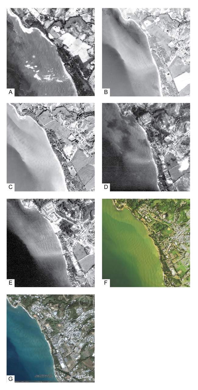
Figure 22. A seven-panel time series of aerial photographs showing complex wave patterns (refraction, reflection, diffraction) in Reach B, Rincón, Puerto Rico study area, (A) 14 March 1951, (B) 21 February 1963, (C) 24 December 1963, (D) March 1983, (E) April 1989, (F) 25 September 2004, and (G) undated recent imagery from GoogleTM Earth (image © 2006 Digital Globe). | ||
