USGS Coastal and Marine Geology Program
Geophysical Data from Offshore of the Chandeleur Islands, Eastern Mississippi Delta
![]() Title Page /
Contents /
Introduction /
Data Acquisition and Processing Overview /
Geographic Information System Data Catalog /
Acknowledgments /
References Cited
Title Page /
Contents /
Introduction /
Data Acquisition and Processing Overview /
Geographic Information System Data Catalog /
Acknowledgments /
References Cited
 |
||
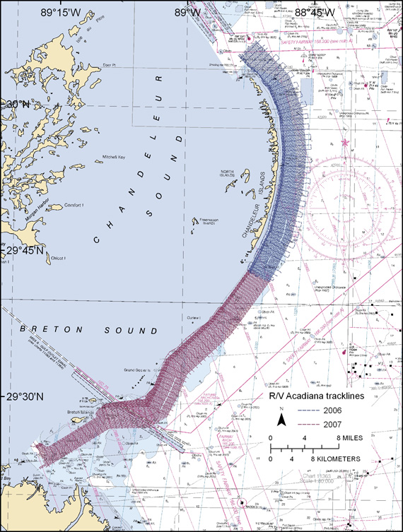
| Figure 2. Geophysical survey areas offshore of the Chandeleur Islands in eastern Louisiana in 2006 and 2007. (Regional location outline shown in fig. 1A) | ||
