USGS - science for a changing world

USGS Coastal and Marine Geology Program

High-Resolution Geologic Mapping of the Inner Continental Shelf: Boston Harbor and Approaches, Massachusetts

Skip past Table of Contents to main text
Title Page
Table of Contents
List of Figures
Section 1
Introduction
Section 2
Maps
Section 3
Data Collection
and Processing
Section 4
Discussion
References
Acknowledgments
Appendix 1
Geographic
Information
System
Appendix 2
Sediment
Texture
Appendix 3
Bottom
Photographs

Appendix 1 - Geographic Information System

A1.1. Data Access

The spatial data on this DVD are delivered as:

  • individual vector and raster datasets.
  • part of a pre-assembled ArcMap or ArcReader project.

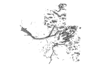
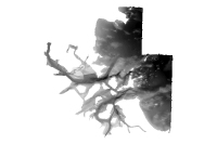
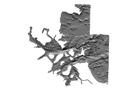
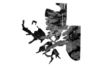
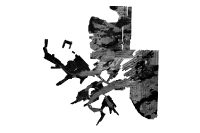
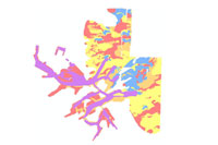
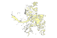
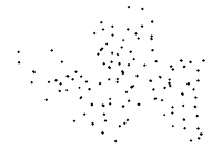
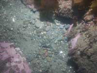
All spatial data can be accessed individually using the table below (link) or by viewing the GIS directory (link) using Windows Explorer or ArcCatalog. Note, all raster data including ESRI grids (bathymetry), ESRI georeferenced tiffs (backscatter), and hyperlinked images (bottom photos and sediment grab photos) are in their native form. Refer to section A1.2 below for more details on where they are located on the DVD.

Projection:
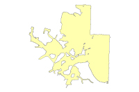
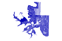
All data are in Universal Transverse Mercator (UTM) Meters, Zone 19, WGS84 Datum.

Viewing the data:
The complete data sets from this project can be accessed in four different ways depending on the software availability.

  • If you have ArcGIS 9.0 or higher - view and manipulate all data
  • If you do not have any GIS software - view all data (free software, ArcReader download required, see below for details)
  • If you have ArcView 3.x - view all data (bathymetry, sidescan sonar mosaic, shapefiles of the bottom photograph and sediment sample locations. Note: Users will need to have Spatial Analyst to view any data in ESRI Grid format).
  • Web pages - view some data (bottom photos, surface sample photos, and maps of bathymetry and sidescan sonar mosaic) as images throughout this report.

If you have ArcGIS 9.0 or higher:
Copy the following folder gis/OFR_2006_1008 to your computer and open the ArcMap document ofr2006_1008.mxd. This will open up an ArcMap document with most of the data layers loaded in the table of contents. The ArcMap project is saved with relative links so there is no need to change any drive letters or pathways as long as you keep all the folders under the parent directory (OFR_2006_1008) the same. You can also view the ArcGIS project directly from the DVD in read only mode by opening up pathway/USGS_1008.mxd. Requirements: you will need approximately 3 gigabytes of free space on your computer if you copy the data to your local drive.

If you do not have any GIS software:
You can still view all the data via ArcReader, a free mapping application distributed by ESRI Inc. You will need to download ArcReader and install it on your computer. Go to the ESRI Web site at http://www.esri.com/software/arcgis/arcreader/download.html and follow the directions for downloading and installing the free software. Once ArcReader is installed on your computer, you can either view the ArcReader project directly from the DVD by opening up [Your_DVD_drive]/gis/OFR_2006_1008/ofr2006_1008.pmf or copy the parent folder gis/OFR_2006_1008 to your local computer as described in the section above.

If you have ArcView 3.x:
If you ArcView 3.x and the spatial analyst extension you can access the shapefiles, grids and image layers (in ESRI grid or tif format) for this project. A description of the rasters and their location on the DVD are provided below in section A1.2. You can also download the locations of sediment samples and bottom photographs in Excel spreadsheet format. These can be added to ArcView as and event theme.

Web Pages:
The JPG images of the bottom photographs and seismic reflection profiles can be accessed and viewed directly from the DVD or via the Web page. They are located in the following folder: [Your_DVD_drive]/gis/OFR_2006_1008/images/hotlinked_photos/.


A1.2 Data Structure on DVD.

This section describes the location of the GIS datasets on this open-file report.

folder.OFR_2006_1008 folder

This folder contains...

folder.Grids-

  1. bh_2mbath - bathymetry (multibeam echosounder data only)
  2. bh_2mhs - shaded relief bathymetry (multibeam echosounder data only)
  3. bh_30mbath - bathymetry grid (combined multibeam and vertical-beam echosounder data)
  4. bh_30mhs - shaded relief bathymetry grid (combined multibeam and vertical-beam echosounder data)

folder.Images

folder.backscatter

  1. bh_1mBS.tif - sidescan-sonar mosaic (1 meter/pixel resolution)
  2. bh_5mBS.tif - sidescan-sonar mosaic (5 meter/pixel resolution)

folder.hotlinked_images-

This folder contains jpeg images of bottom photographs and sediment samples that are hotlinked to the bottomphotos and sedsamp shapefiles.

If you have ArcGIS 9.0 or higher: Use the hotlink feature. The locations of bottom photos and sediment samples are already linked in the ArcMap document OFR_2006_1008.mxd

  1. Open up OFR_2006_1008.mxd
  2. Select the Bottom Photos or Sediment Samples in the table of contents
  3. Select the lightning bolt tool - Images beginning with "22...." are bottom photographs. Images beginning with "BH" are the sediment sample images named by station number. The ArcMap project file document below is already set up with hotlinks.

If you do not have ArcGIS 9.0 or higher:

Use table A3_1 (Excel format) to create an event theme in ArcView 3.x and edit the image pathway to set up hotlinks for the photographs. Table A3_1 has a list of all bottom photographs grouped by station. The photographs are named sequentially, starting with "22356145.jpg" through "22626197.jpg".

folder.Layers-

This folder contains are ArcGIS layer files that store user-defined symbology, labeling, and other display parameters by pointing to the original feature class, grid or tif.

BathymetryGrids.lyr - Depth-colored hillshade bathymetry of both the multibeam echosounder and combined bathymetric datasets.

Bottom Type.lyr - Generalized bottom type derived from slope, backscatter and the ground-validation datasets.

Ground Validation.lyr - Locations of bottom photographs, sediment samples and video transects.

Project Files:

ofr2006_1008.mxd - ArcMap document with all data layers loaded in the table of contents and symbolized as in the report figures. The ArcMap document is saved with relative links so that the hotlink tool will work for the bottom photographs and sediment samples.

ofr2006_1008.pmf - ArcReader file that will enable users without ArcGIS 9.0 to view all the spatial data in the project with a free data viewer (download free ArcReader here).

Table A1. Data Catalog.

file description (metadata
file name
view
file format
file
file size (zipped)
Bathymetry
(Multibeam 2m/pixel)
bh_2mmbbath bh_2mmbbath.jpg. ESRI Grid 32 bit fp mbbath.zip 58 MB
Bathymetric Hillshade
(Multibeam 2m/pixel
)
bh_2mmbhs bh_2mmbhs.jpg. ESRI Grid 16 bit integer mbbath.zip 58 MB
Bathymetry
(Combined 30m/pixel)
bh_30mbath bh_10mbath.jpg. ESRI Grid 32 bit fp cbath.zip < 1MB
Bathymetric Hillshade
(Combined 30m/pixel
bh_30mhs bh_10mhs.jpg. ESRI Grid 16 bit integer cbath.zip < 1 MB
Sidescan Mosaic
(1 meter/pixel)
bh_1mbs bh_1mbs.jpg. TIFF 8 bit integer bh_1mbs.zip 128 MB
Sidescan Mosaic
(5 meters/pixel)
bh_5mbs bh_5mbs.jpg. TIFF 8 bit integer bh_5mbs.zip 5 MB
Bottom Types bottomtype bottomtype.jpg. ESRI Shapefile (polygon) bottomtype zip < 1MB
Bathymetry Bounds
(Multibeam)
multibeambathybnds multibeambathybnds.jpg. ESRI Shapefile (polygon) mbbathybnds zip < 1MB
Bathymetry Bounds
(Combined)
compbathybnds compositebathybnds.jpg. ESRI Shapefile (polygon) compbathybnds.zip < 1MB
Survey Lines
(Sidescan Sonar)
surveylines_sss surveylines_sss.jpg. ESRI Shapefile (lines) surveylines_sss.zip < 1MB
Survey Lines
(Video & Bottom Photos)
surveylines_vid surveylines_vid.jpg. ESRI Shapefile (lines) surveylines_vid.zip < 1MB
Bottom Photos
(Shapefile)
bottomphotos bottomphotos.jpg. ESRI Shapefile (points) bottomphotos.zip < 1MB
Sediment Samples
(Shapefile)
sedgrabs sedgrabs.jpg. ESRI Shapefile (points) sedgrabs.zip < 1MB
Bottom Photos***
(Hotlinkable JPEG)
bottomjpgs.zip BottomPhotos. jpeg bottomjpgs.zip 215 MB
Sediment Samples
(Hotlinkable JPEG)
grabjpgs.zip GrabPhotos. jpeg grabjpgs.zip 3.5 MB

Click here to download zip file of entire data directory*** ofr_2006_1008.zip (file size 410 MB).

***Note: The data directory and zipped file of Bottom Photo JPEGs on the online version of this report contain full-sized but reduced resolution version of the seabed photographs. The highest resolution JPEG photographs can be accessed through the Photo Gallery (online in Appendix 3) or on DVD version of this report.


arrow left  
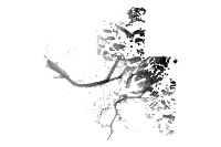
Back to Acknowledgments      arrow up  To Top of Page      arrow rightForward to Next Section  

Skip Navigation

Accessibility FOIA Privacy Policies and Notices

U.S. Department of the Interior | U.S. Geological Survey | Coastal and Marine Geology

URL: cmgds.marine.usgs.gov/publications/of2006-1008/html/appendix1.html
Page Contact Information: CMGDS Team
Page Last Modified: Wednesday, 06-Dec-2017 12:55:27 EST