
Woods Hole Science Center
![]() Title |
Introduction |
Setting |
Methods |
Overview |
Interpretation |
Discussion |
Data Catalog |
Acknowledgments |
References |
Figures |
Bottom Photographs |
Sediment Data |
Contacts
Title |
Introduction |
Setting |
Methods |
Overview |
Interpretation |
Discussion |
Data Catalog |
Acknowledgments |
References |
Figures |
Bottom Photographs |
Sediment Data |
Contacts
 |
||
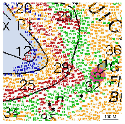
Figure 38. Detailed comparative view of the shoal off Fox Point on Pasque Island. Note that the shoal has prograded seaward, but narrowed on its northeastern side. Colored depths are from the 2004 survey; black depths and contours are from 1976; depths are in feet. Location of view is shown in figure 22. | ||


