
Woods Hole Science Center
Geologic Interpretation and Multibeam Bathymetry of the Sea Floor in the Vicinity of the Race, Eastern Long Island Sound
![]() Title |
Introduction |
Setting |
Methods |
Results |
Discussion |
Data Catalog |
Acknowledgments |
References |
Figures |
Contacts
Title |
Introduction |
Setting |
Methods |
Results |
Discussion |
Data Catalog |
Acknowledgments |
References |
Figures |
Contacts
 |
||
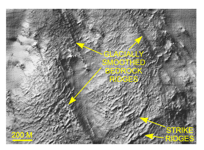
Figure 14. Detailed planar view of the multibeam DTM showing the exposed bedrock surface in the northwestern part of the study area. Glacially-smoothed bedrock ridges parallel similar features and glacial striations onshore (Goldsmith, 1962); strike ridges parallel those of the onshore Avalon Terrane. Location of view is shown in Figure 12. | ||


